
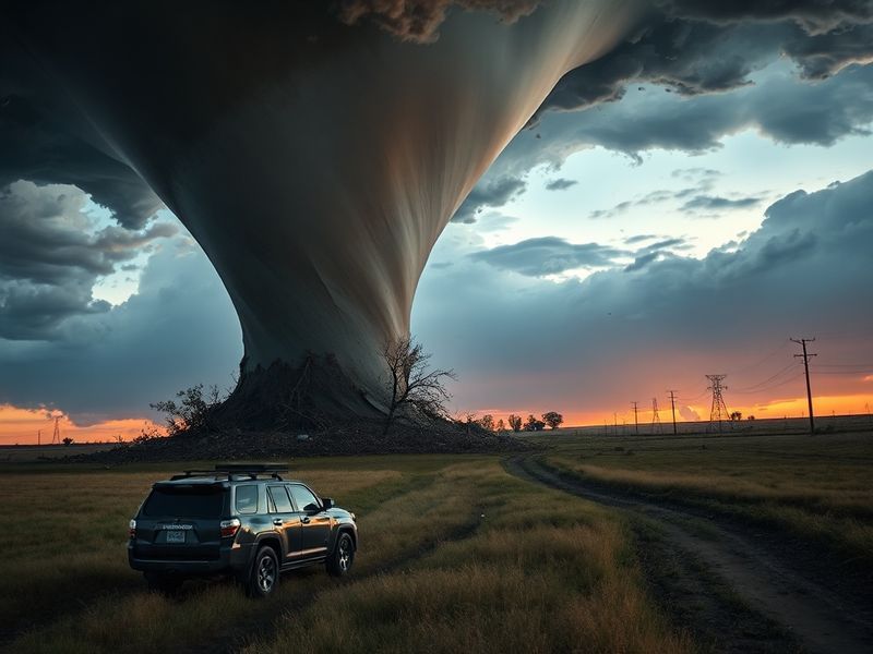
kansas tornadoes
“`html
Kansas Tornadoes: Understanding Nature’s Power in the Heartland
Tornadoes are among the most dramatic and destructive forces of nature, and Kansas sits at the epicenter of this phenomenon. The state’s central location in the U.S. places it squarely within Tornado Alley, a region notorious for frequent and violent twisters. These swirling columns of air can reshape landscapes in minutes, leaving behind paths of destruction that communities spend years rebuilding from.
The relationship between Kansas and tornadoes is deeply rooted in the state’s geography and climate. Warm, moist air from the Gulf of Mexico collides with cool, dry air from Canada and hot, dry air from the Southwest, creating the perfect conditions for severe thunderstorms and tornadoes. This volatile mix has given Kansas a unique—and often challenging—place in the nation’s weather narrative.
Why Kansas Is a Tornado Hotspot
Kansas averages around 96 tornadoes per year, though the number can vary widely from season to season. The peak of tornado season typically runs from late April through June, with May historically being the most active month. The state’s flat terrain and lack of significant geographic barriers allow storms to build intensity without interruption, making it easier for funnel clouds to touch down and become destructive.
Geographically, Kansas is positioned where three major air masses converge. The state’s eastern half is influenced by the Mississippi River Valley’s moisture, while the western regions experience drier conditions from the High Plains. This contrast fuels the development of supercell thunderstorms—rotating storms that often produce the most violent tornadoes. The National Weather Service has documented some of the most destructive tornadoes in U.S. history occurring in Kansas, including the devastating 2007 Greensburg EF5 tornado, which destroyed 95% of the town.
The state’s tornado frequency isn’t just a matter of geography. Kansas also lies along a major storm track that meteorologists call the “Dryline,” where warm, moist air meets dry, hot air. This boundary is a prime location for thunderstorm initiation, especially during the spring and early summer. When combined with strong wind shear—changes in wind speed and direction with altitude—these conditions can lead to the formation of long-lived, rotating supercells capable of spawning multiple tornadoes.
The Science Behind Kansas Tornadoes
Tornadoes in Kansas form through a complex interplay of atmospheric conditions. The process begins with a thunderstorm developing into a supercell, characterized by a persistent, rotating updraft called a mesocyclone. Within this rotating storm, if conditions are right, a funnel cloud may descend from the storm base. When this funnel touches the ground, it becomes a tornado.
Wind shear is critical to tornado formation. In Kansas, wind speeds typically increase with height, and the direction may shift from southerly at the surface to southwesterly aloft. This change in wind speed and direction helps create the horizontal spin that, when tilted vertically by the storm’s updraft, becomes the rotating mesocyclone. The stronger and more organized this rotation, the higher the potential for a violent tornado.
Not all Kansas tornadoes are the same. They vary in size, intensity, and duration. The Enhanced Fujita Scale (EF-Scale), used to rate tornado intensity from EF0 (weak) to EF5 (violent), helps classify these storms based on damage indicators. In Kansas, about 70% of tornadoes are rated EF0 or EF1, causing minor to moderate damage. However, the remaining 30% can reach EF2 or higher, with winds exceeding 135 mph and capable of leveling homes and businesses.
Historical Tornado Events in Kansas
Kansas has witnessed some of the most infamous tornadoes in American history. One of the earliest documented events occurred on May 30, 1942, when an F5 tornado tore through the town of Hesston, killing six people and injuring 100. This storm was part of a larger outbreak that affected multiple states, highlighting the widespread danger tornadoes pose across the Great Plains.
More recently, the 2007 Greensburg tornado stands as a defining moment in Kansas weather history. On the night of May 4, an EF5 tornado with winds exceeding 205 mph struck the small Kiowa County seat. The tornado was nearly 2 miles wide and stayed on the ground for 22 miles, wiping out 95% of the town. Remarkably, no one died in Greensburg due to timely warnings and a well-coordinated emergency response. The event became a case study in disaster preparedness and community resilience.
Another notable event was the April 2012 tornado outbreak, which produced 12 tornadoes across central and eastern Kansas over two days. The most destructive was an EF3 tornado that struck the town of Harveyville, injuring 12 people and causing significant structural damage. This outbreak underscored the importance of early warning systems and public awareness, as many residents had only minutes to react.
Kansas has also experienced some of the longest-track tornadoes on record. The 2013 El Reno tornado, while technically touching down just west of the Kansas border in Oklahoma, produced a massive wedge tornado that crossed into northern Kansas. With a width of 2.6 miles and peak winds of 302 mph, it became the widest tornado ever recorded. Though it did not directly hit major population centers, its sheer size and power served as a stark reminder of nature’s unpredictability.
Preparedness and Safety in Tornado Season
Living in Kansas means accepting that tornado season is a part of life. But preparedness can save lives. The National Weather Service’s Storm Prediction Center issues outlooks days in advance, indicating the potential for severe weather. When a “watch” is issued, it means conditions are favorable for tornadoes, and residents should stay alert. A “warning,” however, means a tornado has been sighted or indicated by radar, and immediate action is required.
Having a reliable way to receive warnings is essential. Outdoor warning sirens, NOAA weather radios, and smartphone alerts can all provide critical minutes of advance notice. The average lead time for tornado warnings has improved significantly over the years, now averaging around 13 minutes nationwide. In Kansas, where storms can develop rapidly, even a few extra minutes can make the difference between life and death.
Families and businesses should have a tornado safety plan in place. This includes identifying a safe room or storm shelter—preferably a basement, storm cellar, or an interior room on the lowest level of a sturdy building. Mobile homes are particularly vulnerable, and residents should seek sturdy shelter well before a warning is issued. Schools, hospitals, and workplaces should conduct regular tornado drills to ensure everyone knows where to go and what to do.
After a tornado, safety remains a priority. Downed power lines may still be live, and gas leaks can pose serious hazards. Residents should avoid entering damaged buildings until authorities have declared them safe. Debris may hide sharp objects or unstable structures, increasing the risk of injury. The recovery process often takes months or years, and communities often rely on mutual aid, insurance, and federal assistance to rebuild.
Community Resilience and Recovery
Kansas communities have shown remarkable resilience in the face of tornadoes. After the Greensburg tornado, the town rebuilt as a model of sustainability, earning LEED Platinum certification for its energy-efficient homes and businesses. The community embraced green technology, including wind turbines and geothermal heating, transforming disaster into an opportunity for innovation.
Local organizations like the American Red Cross and Kansas Emergency Management play crucial roles in response and recovery. Volunteers often arrive within hours to provide food, shelter, and medical assistance. Schools and churches frequently serve as emergency shelters, offering a sense of normalcy during chaotic times.
Long-term recovery also involves mental health support. Survivors of tornadoes often experience trauma, anxiety, and grief. Counseling services and support groups help individuals and families cope with loss and rebuild their lives. The emotional toll of tornadoes is just as real as the physical damage, and addressing it is a vital part of recovery.
Looking Ahead: The Future of Tornado Research and Response
As climate patterns shift, researchers are studying whether tornadoes in Kansas and across the Great Plains are becoming more frequent or intense. Some studies suggest that warming temperatures may increase atmospheric instability, potentially leading to more frequent severe storms. However, the relationship between climate change and tornadoes is complex and still under active research.
Advances in technology are improving tornado detection and warning systems. Dual-polarization radar, introduced in the 2010s, allows meteorologists to see the size, shape, and composition of precipitation particles, making it easier to identify debris lofted by tornadoes. This has improved lead times and reduced false alarms, giving residents more confidence in warnings.
Drones and mobile radar units are also being deployed to collect real-time data from inside storms. Projects like the Targeted Observation by Radars and UAS of Supercells (TORUS) aim to better understand the formation and structure of tornadoes. These efforts could lead to breakthroughs in forecasting, potentially saving lives through earlier and more accurate warnings.
Despite these advances, challenges remain. Urban sprawl is encroaching on rural areas, increasing the potential for property damage and casualties. Additionally, social media and misinformation can sometimes hinder effective communication during emergencies. Ensuring that warnings reach everyone—regardless of language or access to technology—remains a critical priority.
The Role of Education and Awareness
Public education is one of the most effective tools in tornado preparedness. Schools in Kansas often incorporate weather safety into their curricula, teaching students about the signs of severe weather and how to respond. Community workshops and storm spotter training programs, offered by the National Weather Service, help volunteers learn how to identify and report tornadoes safely.
Storm spotters play a vital role in the warning process. Trained volunteers report real-time observations to the National Weather Service, helping confirm radar indications and provide ground truth. Their efforts have saved countless lives by bridging the gap between technology and on-the-ground reality.
As Kansas continues to face the reality of tornadoes, a combination of science, preparedness, and community action will remain essential. While the state cannot control the weather, it can control how it responds. Through continued investment in research, education, and infrastructure, Kansas can build a safer future—one where the power of nature is met with resilience, preparedness, and hope.
For those interested in tracking severe weather or learning more about tornado safety, resources are available through the <