Redistricting Explained: How Maps Shape Political Power
Every ten years, a quiet but consequential process reshapes the boundaries of political representation in the United States. Known as redistricting, this practice involves redrawing the maps that define congressional and state legislative districts. While it may sound like a bureaucratic exercise, redistricting holds immense power over who gets elected, which policies gain traction, and how fairly communities are represented. The stakes are high, and the outcomes often spark intense debate.
At its core, redistricting is about fairness. The U.S. Constitution requires that legislative districts be roughly equal in population, ensuring that each vote carries similar weight. However, the process of drawing these lines has frequently been manipulated to favor one political party, dilute the voting power of certain groups, or protect incumbents. The tools used to achieve these ends—such as gerrymandering—have become a defining feature of modern American politics.
The Mechanics of Redistricting: Who Draws the Lines?
The responsibility for redistricting varies by state. In some cases, state legislatures take the lead, drafting new district maps with input from governors who can veto or approve them. Other states use independent or bipartisan commissions to reduce partisan influence. A few, like California and Arizona, have entrusted the task to citizen-led bodies, aiming to remove politics from the equation.
The process begins after the U.S. Census Bureau releases population data, which happens every decade following the national headcount. States then analyze this data to determine if their existing districts still meet population equality standards. If shifts in population—such as growth in urban areas or declines in rural regions—make current districts unbalanced, lawmakers or commissions must redraw the lines.
This is where things get complicated. The way districts are drawn can dramatically alter political landscapes. For example, packing opponents into a few districts dilutes their overall influence, while cracking their support across multiple districts weakens their ability to win elections. These tactics are not new; the term “gerrymandering” dates back to 1812, when Massachusetts Governor Elbridge Gerry signed a bill that created a district resembling a salamander to benefit his party. The practice has evolved with technology, now relying on sophisticated data analytics to fine-tune district boundaries for maximum partisan advantage.
Why Redistricting Matters: Beyond the Ballot Box
The impact of redistricting extends far beyond election results. The way districts are drawn influences policy priorities, resource allocation, and even the tone of political discourse. When districts are gerrymandered to favor one party, politicians may prioritize pleasing their base over appealing to a broader electorate. This can lead to more polarized legislatures, where compromise becomes increasingly difficult.
Redistricting also plays a critical role in representation. Historically, minority communities have faced barriers to fair representation due to discriminatory districting practices. The Voting Rights Act of 1965 sought to address this by prohibiting practices that dilute minority voting power. However, legal challenges continue to arise, particularly in states where new district maps are accused of suppressing the voices of racial or ethnic groups. For instance, lawsuits have targeted maps in states like Texas and North Carolina for allegedly diluting Black and Latino voting influence.
Beyond politics, redistricting affects everyday life. The districts drawn today will determine which communities receive funding for schools, roads, and public services for the next decade. A district drawn to exclude a growing urban area might miss out on infrastructure investments, while one that includes affluent suburbs could see more resources directed its way. These decisions ripple through local economies and quality of life.
The Tools of the Trade: How Maps Are Drawn
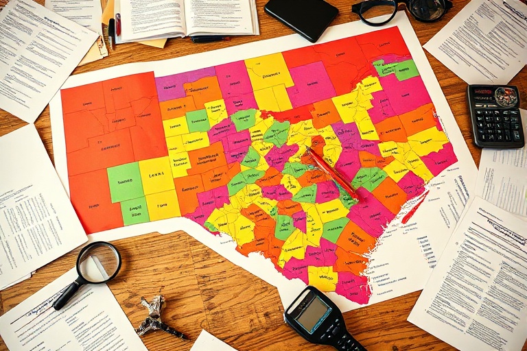
Modern redistricting relies on advanced technology. Political operatives use geographic information systems (GIS) software to analyze demographic data, voting patterns, and community boundaries. These tools allow them to create districts that meet legal requirements while maximizing partisan or electoral advantages. The result is a patchwork of districts that can look bizarre on a map—snaking through cities, splitting neighborhoods, or grouping together areas with little in common.
Critics argue that this level of precision undermines the democratic process. When districts are drawn with surgical precision to favor one party, elections can become less competitive. In some states, incumbents face little challenge in general elections because their districts are designed to ensure their re-election. This can lead to a lack of accountability and fewer incentives for politicians to address the concerns of a diverse electorate.
Controversies and Legal Battles: The Fight Over Fair Maps
Redistricting has long been a flashpoint for legal and political battles. The U.S. Supreme Court has weighed in on the issue multiple times, most recently in 2019 when it ruled that federal courts cannot strike down partisan gerrymanders, leaving the issue largely to state courts and legislatures. This decision underscored the complexity of the problem, as partisan gerrymandering—while widely condemned—remains difficult to define and challenge under existing laws.
State-level battles have been equally contentious. In 2021, for example, Pennsylvania’s Supreme Court struck down a congressional map drawn by the Republican-controlled legislature, ruling that it violated the state constitution by favoring one party. The court replaced it with a map that gave Democrats a better chance of winning seats, illustrating how redistricting outcomes can flip depending on who controls the process.
Another high-profile case involved North Carolina, where a state court ruled in 2022 that Republican-drawn maps were unconstitutionally gerrymandered to dilute Black voting power. The court ordered new maps to be drawn, leading to a shift in the state’s political landscape. These cases highlight the role of courts in policing redistricting, though their interventions are often reactive rather than preventive.
Key Takeaways About Redistricting
To better understand redistricting, consider these essential points:
- Population equality: Districts must have roughly equal population sizes to comply with the “one person, one vote” principle established by the Supreme Court.
- Partisan gerrymandering: The practice of drawing districts to favor one political party over another, often using tactics like “packing” and “cracking.”
- Racial gerrymandering: Prohibited under the Voting Rights Act, this involves drawing districts to dilute the voting power of racial or ethnic minorities.
- Independent commissions: Some states use nonpartisan bodies to draw district lines, aiming to reduce political manipulation.
- Legal challenges: Courts frequently intervene in redistricting disputes, though their rulings can be inconsistent and slow to resolve conflicts.
Looking Ahead: Reform and the Future of Redistricting
As redistricting continues to shape American politics, calls for reform grow louder. Advocacy groups like the League of Women Voters and Common Cause push for transparency and fairness in the process. Proposals range from adopting independent commissions to using algorithmic tools that prioritize compact, contiguous districts over partisan gains.
Technology could also play a role in democratizing redistricting. Open-source mapping tools and public participation platforms allow citizens to propose their own district maps, fostering greater engagement in the process. For example, the state of Michigan used a citizen-led commission for its 2021 redistricting cycle, resulting in maps that were more competitive and less gerrymandered than previous iterations.
Yet, reform faces significant hurdles. Partisan interests are deeply entrenched, and many lawmakers resist changes that could diminish their control over district boundaries. In states where one party dominates, the incentive to alter the status quo is minimal. This resistance underscores the need for sustained public pressure and legal innovation to ensure fairer redistricting practices.
Ultimately, redistricting is a reflection of democracy’s strengths and flaws. It offers a mechanism for adapting political representation to a changing population, but it also exposes the vulnerabilities of a system where power is often concentrated in the hands of a few. As technology and data analytics continue to evolve, the fight for fair maps will remain a defining struggle in American politics.
For those interested in diving deeper into the intersection of politics and technology, explore our Politics and Technology sections for more analysis on how these forces shape our world.
Understanding redistricting is not just about following a process; it’s about recognizing how the boundaries we draw today will define the political landscape for years to come. Whether through reform, litigation, or public engagement, the conversation around fair maps is far from over.