Understanding Tornado Warnings: What They Mean and How to Stay Safe
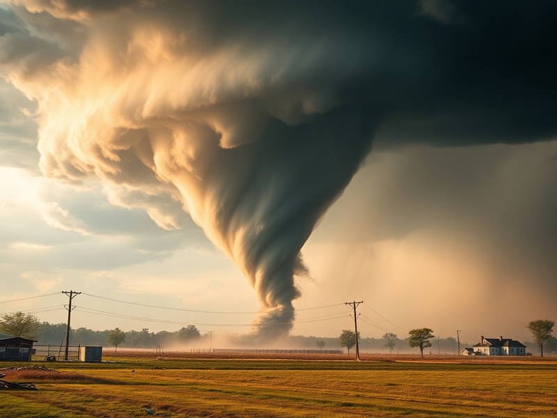
When dark, twisting columns descend from thunderstorm clouds, few sights command attention like a weather tornado warning. Unlike routine thunderstorm alerts, these warnings signal imminent danger to life and property. The National Weather Service issues them only when a tornado has been sighted or detected by radar, giving communities precious minutes to take cover. The difference between a watch and a warning is critical: a watch means conditions are favorable, while a warning means danger is here and now.
The Science Behind the Alert: How Tornado Warnings Work
Tornado warnings are not issued lightly. They result from real-time data analyzed by meteorologists using advanced radar systems like Doppler and dual-polarization. These tools detect rotation within storms, known as a mesocyclone, and changes in wind patterns that suggest a funnel cloud may form or has already touched down. Once confirmed, the warning is broadcast immediately through sirens, emergency alerts, and mobile notifications.
Radar signatures such as the “hook echo” and “debris ball” have become critical indicators. A hook echo appears on radar as a curved appendage at the edge of a storm, often signaling strong rotation. A debris ball, detected through dual-polarization radar, shows irregular patterns of scattered objects lofted into the air—proof a tornado is on the ground, even if not visible. These technological advancements have improved lead times from an average of 5 minutes in the 1980s to over 13 minutes today.
Key Factors That Trigger a Tornado Warning
Several atmospheric conditions must align for a tornado warning to be issued:
- Strong Wind Shear: Winds changing speed and direction with height create horizontal spinning effects that thunderstorms can tilt vertically into a rotating updraft.
- Instability: Warm, moist air near the surface beneath much cooler, dry air aloft creates an unstable environment where storms can rapidly intensify.
- Lift Mechanism: A front, dryline, or outflow boundary forces air upward, initiating thunderstorm development.
- Visible Spinning: Storm spotters or law enforcement confirm a funnel cloud or tornado on the ground, adding human verification to radar data.
Even with these tools, false alarms remain a challenge. Studies show that roughly 70% of tornado warnings do not result in a tornado. While this reduces the risk of missing a real event, it can lead to warning fatigue, where communities grow complacent over time. Balancing urgency with accuracy remains an ongoing challenge for meteorologists.
From Sirens to Smartphones: How Warnings Reach the Public
The effectiveness of a tornado warning depends not only on its accuracy but on how quickly and clearly it reaches the public. Traditional methods—outdoor warning sirens, NOAA Weather Radio, and emergency broadcast systems—remain vital, especially in rural areas with limited internet access. However, digital platforms have transformed alert distribution in the past decade.
Wireless Emergency Alerts (WEAs) push warnings directly to mobile phones, often within seconds of issuance. Apps like The Weather Channel, AccuWeather, and local emergency management systems provide location-based alerts and real-time radar. Social media platforms, including Facebook and Twitter, amplify warnings through official accounts and community groups, sometimes faster than traditional media.
Yet, access isn’t universal. Older adults, low-income households, and people with disabilities may lack smartphones or reliable internet. Language barriers can also delay understanding. In response, many communities have expanded multilingual outreach and installed accessible alert systems, such as text-to-speech features and amplified sirens.
Best Practices for Responding to a Tornado Warning
Knowing what to do during a tornado warning can save lives. The Centers for Disease Control and Prevention recommend the following steps:
- Seek Shelter Immediately: Go to a basement or an interior room on the lowest floor, away from windows. Mobile homes are especially vulnerable—evacuate to a sturdy building if possible.
- Cover Your Body: Use a mattress, heavy blankets, or a helmet to protect against flying debris. Cover your head and neck with your arms.
- Stay Informed: Keep a battery-powered NOAA Weather Radio or phone charger handy. Avoid relying solely on outdoor sirens if you’re indoors.
- Wait for the All-Clear: Do not venture outside until the warning expires or local officials confirm the threat has passed.
Preparation is just as important as reaction. Families should practice tornado drills annually, identify safe rooms, and keep emergency kits stocked with water, non-perishable food, flashlights, and first aid supplies. Schools and workplaces should have clear evacuation and shelter-in-place plans.
Beyond the Alert: The Broader Impact of Tornado Warnings
The ripple effects of tornado warnings extend far beyond the moment of danger. Economically, businesses in tornado-prone regions often face higher insurance premiums and operational disruptions. Schools may close, events get canceled, and supply chains slow as transportation routes are avoided. The psychological toll is significant too—studies link frequent tornado warnings to increased anxiety and stress, particularly in children who may struggle with fear of severe weather.
Climate change is altering the landscape of tornado risk. While the total number of tornadoes each year hasn’t increased dramatically, research suggests they are becoming more clustered in time and space. “Tornado outbreaks”—days with multiple tornadoes—are growing more frequent, and the season is expanding beyond traditional spring and early summer peaks. Warmer temperatures may be fueling stronger storms, though the exact relationship remains under study.
Urban sprawl also plays a role. As cities expand into rural areas, more people live in the path of potential tornadoes. The 2011 Joplin, Missouri tornado, one of the deadliest in modern history, struck a densely populated area, resulting in 161 fatalities and over $2 billion in damages. It prompted calls for improved building codes and early warning dissemination in urban zones.
Lessons from Recent Events
The 2021 tornado outbreak that devastated Kentucky and surrounding states highlighted both progress and gaps in warning systems. Despite advanced radar and forecasting, the long-track tornadoes moved rapidly through multiple states overnight, catching some residents asleep. The event underscored the need for overnight alert systems and community education on recognizing warning tones.
In response, the National Weather Service has increased emphasis on overnight preparedness, including partnerships with hotels and campgrounds to install weather radios and emergency signage. Social media campaigns now include videos demonstrating what a tornado warning siren sounds like and how to react when awakened at night.
Technology continues to evolve. Projects like the Warn-on-Forecast System aim to provide tornado warnings up to an hour in advance by using high-resolution, rapidly updating computer models. While still in development, such systems could revolutionize early warning capabilities and reduce false alarms.
Tornado warnings are more than alerts—they are lifelines. They represent the intersection of science, communication, and community resilience. As climate patterns shift and populations grow, the challenge will be to maintain urgency without inducing complacency, to innovate without overwhelming, and to protect lives in an era where the sky itself seems more unpredictable than ever.