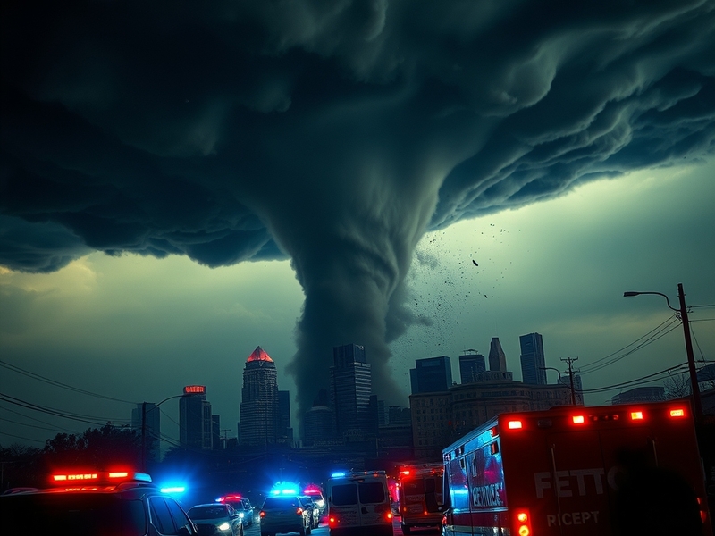
The National Weather Service issued a tornado warning for Detroit late Tuesday evening as severe thunderstorms swept through southeastern Michigan. Radar indicated rotation in the storm cells moving toward the city, prompting urgent alerts for residents to seek shelter immediately. The warning, which lasted approximately 45 minutes, covered Wayne County and parts of Oakland and Macomb counties. While no touchdowns were confirmed, the event underscored the growing unpredictability of severe weather in the Great Lakes region.
Local meteorologists had warned of possible tornadoes hours before the warning was issued. The storms brought heavy rain, hail, and damaging winds, with gusts exceeding 70 mph in some areas. Emergency management officials reported downed trees, power outages affecting thousands, and at least one structural collapse in a residential neighborhood. The rapid escalation from thunderstorm watch to tornado warning highlighted the challenges of real-time weather forecasting in urban environments.
Detroit’s infrastructure, much of it aging and built before modern building codes accounted for extreme weather, appeared particularly vulnerable. The city’s emergency alert system functioned as designed, sending push notifications and activating sirens across multiple districts. Yet the event raised questions about preparedness, response times, and whether residents fully understand the difference between a watch and a warning.
How the Tornado Warning Unfolded
The timeline of the warning reveals how quickly conditions deteriorated. At 9:17 PM, the National Weather Service issued a Severe Thunderstorm Watch for Wayne, Oakland, and Macomb counties. By 10:42 PM, radar signatures showed persistent rotation in storm cells approaching the Detroit city limits. Just 13 minutes later, at 10:55 PM, a Tornado Warning was issued for the entire city of Detroit and surrounding areas.
Emergency broadcasts urged residents to move to interior rooms, away from windows, and to avoid vehicles or mobile homes. Social media erupted with videos of rotating wall clouds and reports of debris being tossed by strong winds. The warning expired at 11:40 PM, but not before leaving residents on edge for nearly an hour. Detroit’s Office of Homeland Security and Emergency Management coordinated with local police and fire departments to monitor the situation in real time.
One notable moment came when a local news helicopter captured footage of a funnel cloud touching down briefly in the city’s southwest side before lifting. While no damage was officially attributed to a tornado, the visual evidence fueled concern. Residents described the scene as chaotic, with emergency dispatchers inundated with calls and power outages plunging some neighborhoods into darkness.
Broader Implications for Urban Weather Preparedness
This event is part of a broader trend: tornadoes are becoming more frequent and intense across the northern United States, including areas not traditionally considered part of “Tornado Alley.” Climate change is altering atmospheric conditions, leading to stronger and more erratic storm systems. Detroit, with its dense population and critical infrastructure, faces unique risks that demand updated emergency planning.
Urban areas like Detroit present challenges for tornado detection and response. Tall buildings can interfere with radar signals, creating blind spots that delay warnings. Additionally, the city’s older housing stock—particularly brick structures and mobile homes—is more susceptible to wind damage than modern suburban developments. Emergency planners are now reevaluating evacuation routes, shelter locations, and communication strategies to address these vulnerabilities.
Another concern is public perception. Many long-time residents grew up hearing that tornadoes “don’t happen here.” That complacency can be deadly when warnings are issued. Education campaigns are essential, but they must be frequent and targeted to reach all demographics, including non-English speakers and residents in underserved neighborhoods.
On a national level, the Detroit warning serves as a case study for how cities can improve resilience. The Federal Emergency Management Agency (FEMA) has emphasized the need for integrated warning systems that combine weather data with real-time infrastructure monitoring. Detroit’s experience could inform similar cities in the Midwest, where aging cities face similar risks.
Lessons from Previous Tornado Events in Michigan
Detroit isn’t the first Michigan city to face a tornado warning in recent years. In 2012, a powerful EF-2 tornado touched down in the city of Dexter, just west of Ann Arbor, causing significant damage and injuring several people. Then, in 2020, a rare EF-3 tornado tore through parts of Grand Rapids, highlighting how even non-traditional tornado zones are at risk.
These events reveal a pattern: Michigan’s tornado frequency has increased by nearly 50% over the past two decades, according to data from the Midwestern Regional Climate Center. The state now averages 16 tornadoes per year, up from a historical average of 11. While not all are strong, the sheer number increases the likelihood of a catastrophic event.
In response, Michigan has expanded its Severe Weather Awareness Week programs and invested in mobile radar units that can be deployed during active storms. Yet gaps remain. For example, many schools and public buildings in Detroit lack designated tornado shelters, relying instead on interior hallways—a stopgap measure that may not withstand extreme winds.
One positive development is the expansion of the Wireless Emergency Alerts (WEA) system. In 2023, the system was updated to include more precise geographic targeting, reducing false alarms in areas not under threat. Detroit’s recent warning benefited from this improvement, with alerts delivered only to affected ZIP codes.
What Residents Should Do Now
For Detroit-area residents, the warning is a reminder to take tornado preparedness seriously. Experts recommend several key steps:
- Identify your safe space: Basements are ideal, but interior rooms on the lowest floor (like bathrooms or closets) work if a basement isn’t available.
- Prepare an emergency kit: Include water, non-perishable food, flashlights, batteries, a first-aid kit, and a portable phone charger.
- Stay informed: Use multiple sources for weather updates, including NOAA Weather Radio, local news stations, and smartphone alerts.
- Practice drills: Know where to go and what to do in under two minutes—the typical warning-to-impact time in urban areas.
- Secure outdoor items: Patio furniture, trash cans, and even decorative items can become projectiles in high winds.
For renters, the responsibility often falls on building owners to provide safe shelter options. If your apartment lacks a basement or sturdy interior room, ask your landlord about designated shelter areas. In Detroit, the city’s Building and Safety Engineering Department offers free inspections to assess structural risks.
Community organizations are also stepping up. The Red Cross of Southeastern Michigan has increased its disaster response training in Detroit, with a focus on vulnerable populations. Local churches and community centers are being retrofitted as emergency shelters, with backup generators and stockpiles of supplies.
The tornado warning in Detroit was a close call, but it served as a wake-up call. As severe weather becomes more common, preparedness isn’t optional—it’s essential. Whether through individual action or community planning, the time to act is now.
For more on how severe weather affects urban infrastructure, visit our News and Analysis sections, where we break down the broader impacts of climate-related events on cities like Detroit.