Indonesia Earthquake Today: Tsunami Risk and Response
An earthquake struck off the coast of Indonesia today, raising immediate concerns about potential tsunami activity. The seismic event occurred in a region long familiar with geological volatility, where tectonic plates collide with relentless force. Authorities have issued preliminary alerts while assessing the full scope of the impact.
Latest Updates on the Earthquake and Tsunami Alerts
According to the Indonesian Meteorology, Climatology, and Geophysical Agency (BMKG), the earthquake registered a magnitude of 6.8 on the Richter scale. The epicenter was located approximately 120 kilometers southwest of Sumatra, at a depth of 35 kilometers. Tsunami warnings were initially triggered for coastal communities, though they were later downgraded after wave activity remained below critical thresholds.
Local officials reported minor structural damage in nearby towns, including cracks in buildings and fallen debris. Emergency response teams were deployed to assess the situation and assist residents. While the tsunami risk has diminished, aftershocks continue to rattle the region, keeping nerves frayed among those still recovering from previous seismic events.
For those tracking real-time developments, BMKG’s official website and social media channels remain the most reliable sources for updates. The agency’s rapid response underscores the importance of preparedness in high-risk zones like Indonesia, where natural disasters are an ever-present reality.
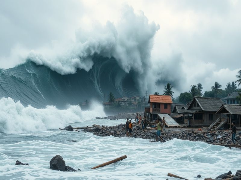
Why Indonesia Faces Frequent Earthquakes and Tsunamis
Indonesia’s geographic location places it directly along the Pacific Ring of Fire, a horseshoe-shaped zone encircling the Pacific Ocean where tectonic activity is particularly intense. This region accounts for about 90% of the world’s earthquakes, including some of the most destructive in recorded history.
The country’s archipelagic structure—comprising over 17,000 islands—further amplifies its vulnerability. When earthquakes occur beneath the ocean floor, the sudden displacement of water can generate tsunamis, which travel at speeds exceeding 500 mph before crashing onto shore with devastating force.
Recent history bears witness to this reality. The 2004 Indian Ocean tsunami, triggered by a 9.1-magnitude quake off Sumatra, claimed over 230,000 lives across 14 countries. More recently, in 2018, a tsunami following a 7.5-magnitude earthquake on Sulawesi Island killed over 4,300 people. These events serve as stark reminders of the region’s susceptibility to geological disasters.
Understanding this context is crucial for both residents and policymakers. While today’s earthquake did not result in a major tsunami, the persistent threat highlights the need for robust infrastructure, early warning systems, and community education.
Lessons from Past Disasters and Preparedness Strategies
Indonesia has made significant strides in disaster preparedness since the 2004 catastrophe. The government has invested in tsunami early warning systems, including buoys and sirens along vulnerable coastlines. Drills and public awareness campaigns are now commonplace, particularly in high-risk areas like Aceh, West Sumatra, and Java.
However, challenges remain. Many rural communities still lack access to real-time alerts due to limited infrastructure. Additionally, the rapid urbanization of cities like Jakarta and Surabaya has led to overcrowded coastal settlements with inadequate building codes.
Experts emphasize the importance of community-based preparedness. Simple measures—such as identifying evacuation routes and storing emergency supplies—can save lives. The Indonesian Red Cross, in collaboration with international organizations, continues to train volunteers who act as first responders during crises.
For travelers and expatriates in the region, staying informed is equally vital. Registering with one’s embassy and using apps like BMKG’s official platform can provide critical updates during emergencies.
Looking Ahead: The Future of Disaster Resilience in Indonesia
The recurrence of earthquakes in Indonesia underscores a harsh truth: natural disasters are not a question of if, but when. While today’s event did not escalate into a major crisis, it serves as a reminder to remain vigilant. Climate change further complicates this equation, as rising sea levels and shifting weather patterns may influence seismic behavior in unpredictable ways.
Advancements in technology offer hope. AI-driven seismic monitoring and satellite-based early warning systems are being tested to improve response times. Meanwhile, international cooperation remains essential, with countries like Japan and the United States sharing expertise in disaster management.
For now, Indonesia’s resilience is tested once again. The government’s swift response to today’s earthquake demonstrates progress, but the road to full preparedness is long. Communities must continue to adapt, learning from past mistakes while embracing innovation.
As the region braces for aftershocks and future tremors, one thing is clear: preparedness is not optional. It is the difference between survival and devastation.
Key Takeaways from Today’s Earthquake
- Magnitude and Location: A 6.8-magnitude earthquake struck southwest of Sumatra, at a depth of 35 km.
- Tsunami Risk: Initial alerts were issued but later downgraded as wave activity remained low.
- Infrastructure Impact: Minor damage reported in coastal towns, with emergency teams assessing further risks.
- Preparedness Gaps: Rural areas still face challenges in accessing real-time alerts and resources.
- Future Preparedness: Investments in technology and community training are critical to mitigating future disasters.
For more insights on disaster preparedness and global events, explore our News and Science sections on Dave’s Locker.