nws radar
Understanding NWS Radar: A Tool Shaping Global Weather Preparedness
The National Weather Service (NWS) radar system represents one of the most critical advancements in meteorological technology, providing real-time data that influences decisions from local commutes to international disaster response. With roots tracing back to mid-20th century military radar adaptations, this system has evolved into a cornerstone of public safety infrastructure. Its reach extends far beyond U.S. borders, serving as a reference model for weather monitoring networks worldwide.
Unlike basic weather forecasts that rely on historical patterns, NWS radar delivers live snapshots of atmospheric conditions. Doppler technology, the system’s backbone, measures not just precipitation but also wind speed and direction within storms. This capability transforms how communities prepare for hazards like hurricanes, tornadoes, and flash floods—events that disproportionately impact vulnerable regions from Southeast Asia to the Caribbean.
The Science Behind the System: How NWS Radar Works
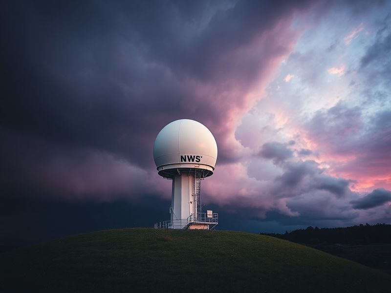
The technical foundation of NWS radar begins with a network of 159 high-resolution Doppler radar sites strategically positioned across the contiguous United States, Alaska, Hawaii, and U.S. territories. Each site operates a WSR-88D (Weather Surveillance Radar, 1988, Doppler) unit, which emits radio waves that bounce off precipitation particles. The returning signals reveal not only the location and intensity of storms but also the velocity of movement within them.
The system’s precision stems from three core components:
- Transmitter: Generates radio waves at a frequency of 2.7–3.0 GHz, allowing penetration through dense cloud cover.
- Receiver: Captures reflected signals, converting them into digital data for analysis.
- Signal Processor: Filters noise and calculates metrics like reflectivity (indicating precipitation density) and radial velocity (measuring wind patterns).
Beyond hardware, the NWS radar network relies on sophisticated software for data integration. The Advanced Weather Interactive Processing System (AWIPS) merges radar outputs with satellite imagery, surface observations, and numerical weather prediction models. This fusion creates a multi-layered view of atmospheric conditions, enabling meteorologists to issue warnings with greater accuracy and lead time.
Global Influence: How Other Nations Adapt NWS Radar Technology
The NWS radar model has inspired adaptations worldwide, though implementation varies by regional needs and resources. In Europe, the Integrated Nowcasting through Comprehensive Analysis (INCA) system blends Doppler radar data with high-resolution numerical models to deliver localized forecasts. Meanwhile, Japan’s JMA Radar Network incorporates dual-polarization technology, which distinguishes between rain, hail, and even volcanic ash—critical for a country frequently threatened by typhoons and seismic activity.
Developing nations face unique challenges in adopting radar systems due to cost and infrastructure limitations. However, initiatives like the World Meteorological Organization’s (WMO) Severe Weather Forecasting Demonstration Project (SWFDP) have facilitated technology transfers. For example, Kenya’s Meteorological Department partnered with the NWS to deploy a mobile radar unit, improving early warnings for floods and droughts that affect millions in the Horn of Africa.
Cultural context also shapes radar utilization. In India, where monsoon seasons dictate agricultural cycles and economic stability, the India Meteorological Department (IMD) integrates radar data with traditional knowledge systems. Farmers rely on these forecasts to time planting and harvesting, while urban planners use storm surge predictions to design resilient infrastructure in coastal cities like Mumbai.
Real-World Impact: Case Studies of Radar-Driven Decisions
The practical value of NWS radar becomes evident in crisis scenarios. During Hurricane Harvey in 2017, the system’s high-resolution data allowed the NWS to issue flood warnings 48 hours before landfall, saving countless lives in Texas and Louisiana. Similarly, the 2013 Moore, Oklahoma, tornado prompted a review of how radar-derived products like the “tornadic debris signature” could enhance warning times for emergency responders.
Beyond emergencies, radar data informs everyday decisions. Airlines use NWS radar feeds to reroute flights around turbulence, while sports venues like stadiums and golf courses rely on it to delay or cancel events during lightning threats. Even the beverage industry benefits: brewers in the Pacific Northwest time hop harvests based on radar-detected humidity shifts, ensuring optimal barley quality for craft beer production.
Yet, challenges persist. Urban areas with tall buildings can create “radar shadows” that obscure low-level storm features, while mountainous terrain like the Rockies complicates signal interpretation. The NWS addresses these gaps through gap-filling radar installations and community-based observation networks, such as the Collaborative Adaptive Sensing of the Atmosphere (CASA) project.
Looking Ahead: The Future of Radar in a Changing Climate
The next frontier for NWS radar lies in artificial intelligence and machine learning. Researchers are training algorithms to detect subtle storm signatures that human analysts might miss, particularly in rapidly intensifying events like derechos. The NWS’s “Warn-on-Forecast” initiative aims to reduce false alarms by 50% while increasing lead times for tornado warnings to 60 minutes or more.
Climate change further underscores the need for innovation. Rising sea levels and shifting jet streams are intensifying precipitation patterns, making real-time radar data indispensable. Projects like the National Oceanic and Atmospheric Administration’s (NOAA) “Next Generation Weather Radar” (NEXRAD) program plan to upgrade 122 existing radar sites with dual-polarization upgrades by 2025, enhancing their ability to distinguish between rain and hail—a critical distinction in a warming climate.
Globally, the push for interoperability continues. The WMO’s Global Multi-Hazard Alert System seeks to standardize radar data formats, enabling seamless sharing between nations. Such cooperation could prove vital in regions like Southeast Asia, where monsoon floods and tropical cyclones transcend borders, demanding coordinated responses.
Why NWS Radar Matters Now More Than Ever
In an era where weather-related disasters are becoming more frequent and severe, the NWS radar network stands as a testament to how technology can bridge gaps between prediction and prevention. Its influence stretches from the rice paddies of Vietnam to the skyscrapers of Dubai, where engineers use radar-derived wind profiles to design earthquake-resistant structures.
The system’s legacy is not just in the data it produces but in the lives it saves. As climate patterns shift and populations grow, the demand for precise, actionable weather intelligence will only increase. For meteorologists, policymakers, and ordinary citizens alike, NWS radar remains an indispensable tool—one that transforms uncertainty into preparation, and chaos into order.
For those interested in exploring further, the NWS offers free access to its radar data through the public interface, while educational resources like NOAA’s JetStream program provide deeper insights into atmospheric science. In a world where the weather is anything but predictable, tools like NWS radar remind us that knowledge, when wielded wisely, can be a shield against the storm.