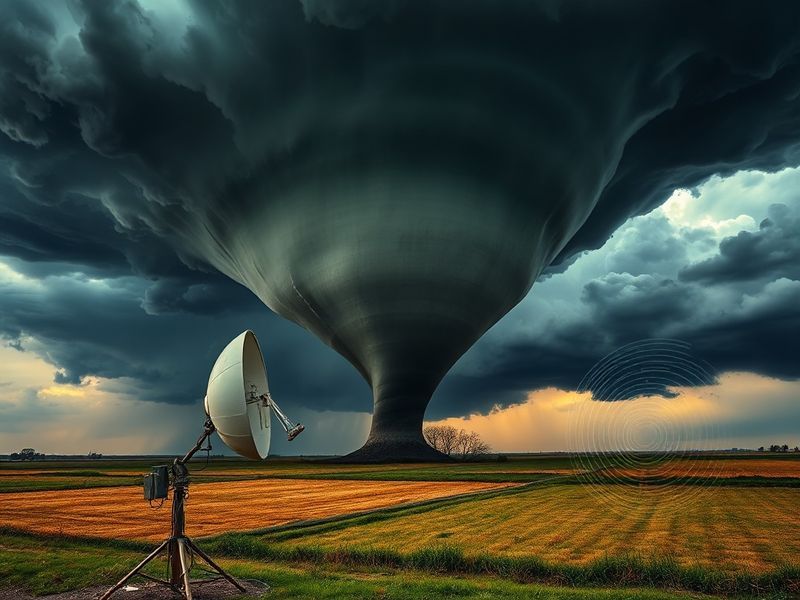
tornado radar
“`html
Tornado Radar: How Technology Tracks Nature’s Most Violent Storms
Tornadoes remain among the most unpredictable and destructive forces in nature, capable of reshaping landscapes and communities in minutes. While their formation cannot be prevented, modern radar technology has revolutionized how meteorologists detect, track, and warn about these violent storms. The evolution from simple weather balloons to today’s high-resolution Doppler systems reflects decades of innovation driven by necessity and human ingenuity.
Globally, tornadoes occur most frequently in the United States, particularly in the region known as Tornado Alley, stretching from Texas to South Dakota. However, they are not confined to one country. Countries like Bangladesh, Argentina, and parts of Europe also experience significant tornado activity, often with devastating consequences due to limited warning infrastructure. In these regions, access to reliable tornado radar data can mean the difference between safety and catastrophe.
The Science Behind Tornado Radar: From Doppler to Dual-Polarization
The foundation of modern tornado detection lies in radar systems that measure precipitation, wind speed, and direction. Traditional weather radar, developed in the mid-20th century, provided basic reflectivity data—essentially showing where rain or hail was falling. While useful, this was not enough to identify a developing tornado until it was often too late.
The breakthrough came with the introduction of Doppler radar in the 1980s and 1990s. Doppler radar detects the motion of precipitation particles, allowing meteorologists to observe rotation within thunderstorms. This rotation, known as a mesocyclone, is often a precursor to tornado formation. The National Weather Service in the U.S. upgraded its network to Doppler systems in the 1990s, leading to a significant increase in lead time for tornado warnings.
More recently, dual-polarization radar has enhanced detection capabilities. Unlike conventional radar, which sends out a single horizontal pulse, dual-polarization systems send both horizontal and vertical pulses. This allows for better identification of hail, debris, and the shape of precipitation particles—key indicators of a tornado on the ground. During the 2013 Moore, Oklahoma tornado, dual-polarization data helped confirm the presence of debris lofted by the storm, providing definitive evidence of a tornado even when visual confirmation was impossible.
How Radar Data Is Translated Into Life-Saving Warnings
Radar doesn’t just detect tornadoes—it powers the entire warning ecosystem. When Doppler radar identifies rotation within a storm, the National Weather Service issues a tornado watch, indicating that conditions are favorable for tornadoes. If rotation tightens and a debris signature appears on dual-polarization radar, a tornado warning is issued, giving residents precious minutes to seek shelter.
In countries with advanced meteorological services, such as Japan and parts of Europe, radar networks are integrated with real-time alert systems that push notifications to mobile phones. In Bangladesh, where tornadoes often strike with little warning, international collaborations are helping deploy low-cost radar systems and training local forecasters to interpret data. These efforts highlight how technology, when accessible, can transcend borders and save lives.
But radar isn’t infallible. False alarms and missed detections still occur. A 2021 study in the Journal of Applied Meteorology and Climatology found that while Doppler radar improves detection, it can struggle in complex terrain or when storms are obscured by heavy rain. This underscores the importance of combining radar data with other tools, such as satellite imagery, storm spotters, and machine learning models that predict storm evolution.
Global Perspectives: How Different Countries Use Tornado Radar
The approach to tornado radar varies significantly around the world, shaped by geography, resources, and risk perception. In the United States, the $150 million Next-Generation Radar (NEXRAD) network consists of 160 high-resolution Doppler radars covering nearly the entire country. This dense coverage enables nearly continuous monitoring and rapid updates during severe weather events.
In contrast, Canada’s radar network, though extensive, is sparser due to the country’s vast, sparsely populated northern regions. Meteorologists rely heavily on satellite data and numerical weather prediction models to fill gaps. Similarly, in Australia, tornadoes—known locally as “willy-willies” in some regions—are less frequent but still dangerous. The Bureau of Meteorology uses a mix of Doppler radar and volunteer storm spotter networks to monitor developing systems.
In Europe, tornadoes are less common but often highly destructive when they occur. Countries like France and Germany have seen deadly tornadoes in recent years, prompting investment in mobile radar units that can be deployed to high-risk areas during severe weather outbreaks. Poland and Italy have also expanded their radar networks, recognizing that climate change may be increasing tornado frequency in the region.
In South Asia, where tornadoes are less documented but potentially catastrophic, organizations like the Indian Meteorological Department are working with international partners to improve radar coverage. The 1989 Manikganj tornado in Bangladesh, which killed over 1,300 people, remains one of the deadliest in history. Today, efforts are underway to ensure that no community is left without warning again.
Cultural and Human Impact: When Technology Meets Community Response
Radar technology doesn’t operate in a vacuum. Its effectiveness depends on how well warnings are communicated and how communities respond. In the U.S., the phrase “get to your basement or interior room” has become a cultural shorthand for tornado preparedness, ingrained through drills, media coverage, and public education campaigns. Schools, hospitals, and businesses conduct regular tornado drills, reinforcing the message that seconds count.
In contrast, in rural parts of Argentina or India, where infrastructure is less developed, reliance on radar must be paired with community-based alert systems. In some regions, sirens are still the primary warning mechanism, while in others, text messages or social media alerts are used. The challenge lies not just in detecting the storm, but in ensuring that the warning reaches everyone, including marginalized and remote populations.
Cultural attitudes toward weather also shape response. In Japan, where typhoons and earthquakes dominate disaster awareness, tornado preparedness is less ingrained. Yet, the 2012 Tsukuba City tornado, which injured over 30 people, prompted a reevaluation of local warning systems. The government now integrates radar data with regional emergency broadcasts, recognizing that even in a country known for seismic activity, tornadoes demand attention.
Technology companies have also played a role. Apps like Weather Underground and AccuWeather provide real-time radar feeds and push notifications, empowering individuals to make split-second decisions. These tools democratize access to life-saving information, though they also raise questions about digital equity—what happens when not everyone has a smartphone?
The Future of Tornado Radar: AI, Drones, and Beyond
The next frontier in tornado detection lies in artificial intelligence and unmanned systems. Machine learning models trained on decades of radar data can now predict storm intensification with greater accuracy than traditional methods. In 2023, researchers at the University of Oklahoma developed an AI system that improved tornado warning lead times by up to 15 minutes in test cases.
Drones are also entering the fray. Equipped with sensors and cameras, drones can fly into the periphery of severe storms, collecting data that ground-based radar cannot. Projects like the Tornado Intercept Vehicle in the U.S. and experimental drone programs in Europe aim to fill critical gaps in real-time observation.
Another promising development is phased-array radar, which scans the sky electronically rather than mechanically. This technology allows for faster updates—up to 30 scans per minute, compared to the 4-5 scans per minute of traditional radar. During the 2020 Nashville tornado, a phased-array system provided near-continuous tracking, offering unprecedented detail on the storm’s evolution.
Yet challenges remain. Funding for advanced radar systems is uneven across the globe. Climate change is altering storm patterns, making historical data less reliable. And as technology advances, so too does the need for skilled meteorologists who can interpret complex data and communicate it effectively to the public.
Building Resilience in a Changing Climate
As global temperatures rise, the frequency and intensity of severe thunderstorms—and the tornadoes they produce—are expected to increase in some regions. The Intergovernmental Panel on Climate Change (IPCC) projects that by 2050, parts of the U.S. Midwest and Europe may see a higher frequency of tornado outbreaks. This makes investment in radar technology not just a scientific endeavor, but a public safety imperative.
Communities must also adapt. Urban planning that incorporates tornado-resistant infrastructure, such as reinforced safe rooms in homes and businesses, can reduce casualties. Public education campaigns must evolve to reach diverse populations, using multilingual alerts and community leaders as trusted messengers.
Ultimately, tornado radar is more than a tool—it’s a lifeline. From the plains of Oklahoma to the rice fields of Bangladesh, the ability to see the invisible forces of nature before they strike is a triumph of human innovation. But technology alone cannot prevent disaster. It must be paired with preparedness, equity, and a commitment to ensuring that no one is left in the dark.
Key Takeaways: What You Should Know About Tornado Radar
Tornado radar has transformed how we understand and respond to one of nature’s most violent phenomena. Here are the essential points to remember:
- Doppler radar detects wind rotation within storms, a key indicator of tornado potential.
- Dual-polarization radar improves accuracy by identifying debris and hail, confirming tornado presence.
- Global access to radar data is uneven, with advanced systems in the U.S. and Europe, but limited coverage in parts of Africa, Asia, and South America.
- Warning systems rely on more than radar—spotters, satellites, and community networks play critical roles.
- The future includes AI, drones, and phased-array radar, promising faster, more precise detection.
- Climate change may increase tornado risks in some regions, making investment in radar and preparedness even more urgent.
For those living in tornado-prone areas, staying informed means more than checking a weather app. It means understanding how radar works, knowing the difference between a watch and a warning, and having a plan in