San Andreas Fault Earthquake Risks: Science, History, and Preparedness
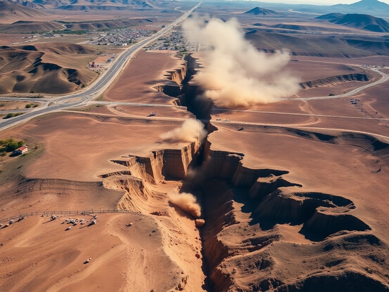
The San Andreas Fault is one of the most closely monitored geological features on Earth. Stretching approximately 800 miles through California, this massive fracture in the Earth’s crust marks the boundary between the Pacific Plate and the North American Plate. While it appears as a linear valley in some areas, it manifests as dramatic cliffs in others, a silent reminder of the immense tectonic forces at play beneath the surface.
Earthquakes along the San Andreas Fault are not a matter of if, but when. The fault’s history is punctuated by catastrophic events, each reshaping the landscape and leaving lasting impacts on communities. Understanding its mechanics, history, and preparedness measures is essential for anyone living in or visiting California.
The Science Behind the San Andreas Fault
The San Andreas Fault is a transform fault, meaning it accommodates horizontal motion between two tectonic plates. The Pacific Plate moves northwest relative to the North American Plate at an average rate of about 2 inches per year. While this movement is imperceptible in daily life, over decades and centuries, it accumulates stress that is eventually released in the form of earthquakes.
The fault is divided into three main segments, each with distinct behaviors:
- Northern Segment: Extends from Shelter Cove to San Francisco, including the infamous 1906 earthquake that devastated the city.
- Central Segment: Runs from San Francisco to near Parkfield, characterized by steady, slow movement known as fault creep.
- Southern Segment: Stretches from Parkfield to the Salton Sea, posing the highest risk for a major earthquake due to its long period of inactivity.
Scientists use seismometers, GPS, and satellite data to monitor these segments, tracking minute shifts that could indicate an impending rupture. The southern segment, in particular, has drawn significant attention due to its potential to generate a magnitude 7.8 or greater quake, which could have devastating consequences for Los Angeles and surrounding areas.
Historical Earthquakes and Their Impact
The San Andreas Fault has produced some of the most destructive earthquakes in U.S. history. The 1906 San Francisco earthquake, with an estimated magnitude of 7.9, caused fires that destroyed much of the city and resulted in over 3,000 deaths. More recently, the 1989 Loma Prieta earthquake, measuring 6.9, struck during the World Series and caused widespread damage in the Bay Area.
However, the most feared scenario involves a rupture along the southern segment. The 1857 Fort Tejon earthquake, estimated at magnitude 7.9, produced ground shaking for nearly three minutes and offset the ground by up to 30 feet in some areas. A similar event today would likely cause catastrophic infrastructure failures, including collapsed bridges, ruptured gas lines, and widespread power outages.
Historical records also reveal that the southern segment experiences major earthquakes roughly every 150 years. Given that the last significant quake in this region occurred over 300 years ago, the probability of a major event in the near future is alarmingly high.
The Human and Economic Cost of a Major Quake
A major earthquake along the San Andreas Fault would not only claim lives but also cripple the state’s economy. California’s gross domestic product exceeds $3 trillion, making it the largest subnational economy in the world. Disruptions to supply chains, telecommunications, and transportation networks could have ripple effects across the globe.
The U.S. Geological Survey (USGS) estimates that a magnitude 7.8 quake on the southern San Andreas Fault could result in:
- Nearly 2,000 deaths and 50,000 injuries.
- Economic losses exceeding $200 billion.
- 1,600 fires ignited by ruptured gas lines.
- Water and electricity outages lasting weeks or even months in some areas.
Infrastructure vulnerabilities are a particular concern. Many of California’s hospitals, schools, and bridges were built before modern seismic safety standards were implemented. Retrofitting these structures is an ongoing challenge, with costs often delaying necessary upgrades.
Emergency response systems would also be overwhelmed. The California Office of Emergency Services has conducted simulations, such as the 2018 “ShakeOut” drill, which revealed that first responders could be stretched thin in the aftermath of a major quake. Mutual aid agreements with neighboring states and federal assistance would be critical in such a scenario.
Preparedness: What Can Be Done?
While earthquakes cannot be prevented, their impacts can be mitigated through preparedness. California has taken steps to improve resilience, including updating building codes and expanding early warning systems like ShakeAlert, which provides seconds to minutes of advance notice before shaking arrives.
Individuals and families can also take proactive measures:
- Secure Your Home: Bolt bookshelves to walls, strap down water heaters, and install automatic gas shutoff valves to prevent fires.
- Create an Emergency Kit: Include water, non-perishable food, medications, flashlights, and a first-aid kit. Aim for at least three days of supplies.
- Develop a Plan: Identify safe spots in your home, such as under sturdy furniture, and establish a meeting point for family members if separated.
- Know the Risks: Familiarize yourself with local fault lines and evacuation routes. Areas near the coast may also face tsunami risks following a major quake.
Public awareness campaigns, such as the Great California ShakeOut, encourage residents to practice “Drop, Cover, and Hold On” drills annually. These efforts are vital in fostering a culture of preparedness, ensuring that when the next big quake strikes, communities are ready to respond effectively.
For those interested in further reading, the Science section of Dave’s Locker offers in-depth coverage of geological phenomena and their impacts on society.
Looking Ahead: The Future of the San Andreas Fault
The San Andreas Fault will continue to shape California’s landscape and destiny for millennia. While scientists cannot predict the exact timing of the next major quake, advancements in technology are improving our understanding of fault behavior. Machine learning algorithms are now being used to analyze seismic data, potentially identifying patterns that precede large ruptures.
International collaboration is also enhancing preparedness. California has partnered with Japan and Mexico, both of which have experienced devastating quakes, to share best practices in earthquake engineering and emergency response. These exchanges highlight the global nature of seismic risk and the need for coordinated solutions.
As climate change intensifies droughts and wildfires, another layer of complexity emerges. Dry conditions can exacerbate soil liquefaction during an earthquake, while post-quake fires could spread rapidly in parched landscapes. Addressing these interconnected risks requires a holistic approach to disaster resilience.
The San Andreas Fault is more than a geological curiosity; it is a defining feature of California’s identity. Its power demands respect, its unpredictability requires vigilance, and its impacts necessitate action. By investing in research, infrastructure, and public education, we can reduce the toll of future earthquakes and build a more resilient future for the Golden State.