Why Hawaii’s Hurricane Tracker Is Your Best Defense Against Storm Season
Hawaii’s unique geography makes it both a paradise and a potential target for tropical storms. Unlike the U.S. mainland, where hurricanes frequently make landfall, the islands sit in a less predictable zone. This means residents and visitors need reliable tools to monitor developing systems. A well-designed hurricane tracker isn’t just a convenience—it’s a critical resource for safety and preparedness.
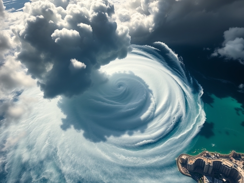
The Pacific Ocean generates some of the most intense hurricanes on record, and Hawaii’s isolation in the central Pacific amplifies the challenge. Storms can form thousands of miles away, only to intensify rapidly as they approach the islands. Tracking these systems in real time requires more than just a weather app—it demands a specialized platform that integrates live satellite data, wind speed projections, and evacuation route updates. Without it, communities risk being caught off guard by sudden shifts in a storm’s path.
The Evolution of Hawaii’s Hurricane Tracking Systems
Decades ago, tracking hurricanes in Hawaii relied almost entirely on manual observations and radio updates. Forecasters used teletype machines to share data from ships and weather stations, a process that could take hours. Today, technology has transformed this system into a high-speed, data-driven network. Modern trackers pull information from the National Oceanic and Atmospheric Administration (NOAA), the Central Pacific Hurricane Center, and advanced computer models that simulate storm behavior.
One of the most significant advancements is the integration of machine learning into forecasting. Algorithms now analyze historical storm patterns, ocean temperatures, and atmospheric pressure to predict where a hurricane might go. While no model is perfect, these tools provide earlier warnings and more accurate long-range projections. For Hawaii, where storms can stall or change course abruptly, this precision saves lives.
Another key development is the rise of crowdsourced weather data. Apps and websites now allow residents to report real-time conditions, such as flooding or power outages, which are then overlaid onto official maps. This community-driven approach fills gaps in traditional monitoring, especially in remote areas like the Big Island or Molokai, where infrastructure is sparse.
How to Use a Hurricane Tracker Effectively in Hawaii
A hurricane tracker is only as useful as the person interpreting its data. Many users make the mistake of fixating on a single model or ignoring the margin of error in forecasts. Here’s how to get the most out of these tools:
- Cross-check multiple sources: Relying on one app or website can be misleading. Compare projections from NOAA, the Central Pacific Hurricane Center, and independent trackers like Windy or Cyclocane. Each uses slightly different data sets, so discrepancies can highlight uncertainty in the storm’s path.
- Monitor the cone of uncertainty: The familiar “cone” on tracking maps shows where a storm’s center is likely to go, but it doesn’t account for size or intensity. A storm passing just north of the islands can still bring hurricane-force winds and torrential rain to populated areas like Oahu or Maui.
- Set up alerts: Most trackers allow custom notifications for wind speeds, storm surge, or flash flood warnings. In Hawaii, where cell service can be spotty in rural areas, these alerts can be lifesaving. Enable them even if you’re just visiting—tourists are often the last to receive official warnings.
- Plan evacuation routes in advance: Don’t wait for a hurricane warning to figure out where to go. Use the tracker to identify high-risk zones and pre-plan your route to shelters or higher ground. In Hawaii, flash flooding and landslides are major concerns, so avoid valleys or coastal roads during a storm.
It’s also worth noting that Hawaii’s hurricane season runs from June to November, with peak activity in August and September. However, storms can form outside this window, as seen with Hurricane Lane in 2018, which struck in late August but lingered for days. A good tracker will provide year-round monitoring, not just during the official season.
Beyond the Storm: The Broader Impact of Hurricanes on Hawaii
Hurricanes don’t just threaten lives—they disrupt entire ecosystems and economies. When a storm like Hurricane Douglas in 2020 grazed Oahu, it caused an estimated $20 million in damage to homes and infrastructure. Power outages lasted for days, and agricultural losses from wind-damaged crops ran into the millions. For a state where tourism accounts for nearly 20% of the economy, even a near-miss can have ripple effects.
The environmental toll is equally severe. Hawaii’s delicate coral reefs, already stressed by warming oceans, can suffer further damage from storm surges that dump debris and pollutants into the water. Invasive species, often spread by floodwaters, can devastate native forests and wildlife. After Hurricane Iniki in 1992, the island of Kauai saw a surge in invasive plants that outcompeted native species, altering the landscape for decades.
Climate change is exacerbating these challenges. Warmer ocean temperatures provide more fuel for hurricanes, while rising sea levels increase the risk of storm surges flooding coastal communities. A study published in Nature Climate Change projects that the intensity of Pacific hurricanes could increase by up to 10% by 2100. For Hawaii, this means storms that were once rare may become more frequent—and more destructive.
Local governments are taking steps to adapt. Honolulu has invested in green infrastructure, such as permeable pavement and rain gardens, to reduce flooding. The state has also expanded its hurricane preparedness programs, including the “Ready Hawaii” initiative, which provides resources for residents to create emergency kits and family plans. But individual preparedness remains crucial, especially in a place where emergency services can be stretched thin during a major event.
What’s Next for Hawaii’s Hurricane Tracking Technology?
The future of hurricane tracking in Hawaii lies in two key areas: automation and accessibility. AI-driven models are becoming more sophisticated, with tools like NOAA’s Hurricane Analysis and Forecast System (HAFS) offering hyper-local predictions. These systems can zoom in on specific islands or even neighborhoods, providing granular data that was unimaginable a decade ago.
Accessibility is also improving. While many trackers cater to weather enthusiasts, new platforms are being designed with broader audiences in mind. Features like multilingual alerts (critical in a state with a diverse population) and simplified interfaces for seniors or those with disabilities are becoming standard. Companies like Dave’s Locker are also exploring partnerships with local schools to integrate storm preparedness into STEM education, ensuring the next generation knows how to respond.
Another promising development is the use of drones and unmanned aerial vehicles to gather real-time data. In 2023, NOAA tested drones in the Pacific to collect wind and temperature readings from inside hurricanes. This data could revolutionize forecasting, giving forecasters a clearer picture of a storm’s structure before it nears land.
Yet, challenges remain. Hawaii’s isolated location means internet outages during storms can cut off access to trackers entirely. Backup systems, such as satellite phones or ham radio networks, are still relied upon by emergency responders. As technology advances, ensuring redundancy in communication systems will be just as important as improving the models themselves.
Staying Safe When the Next Storm Hits
The best hurricane tracker in the world is useless if people don’t act on its warnings. Hawaii’s culture of resilience is a strength, but it can also lead to complacency. After all, many residents have weathered storms without major incidents—until they don’t. The key is to treat every hurricane season as if it could bring the worst-case scenario.
Start by bookmarking reliable trackers and signing up for official alerts. The Central Pacific Hurricane Center’s website and the National Weather Service’s Honolulu office are the gold standard. Keep your emergency kit stocked with at least a week’s supply of water, non-perishable food, and medications. Don’t forget to secure outdoor furniture, trim trees, and clear gutters to prevent debris from becoming projectiles.
If you’re visiting Hawaii during hurricane season, check your hotel or rental’s storm policy. Many resorts have designated shelters, and airlines often waive change fees if a storm approaches. Pay attention to local news, which will provide updates on road closures, school closures, and evacuation orders. Remember, even a tropical storm can bring life-threatening conditions—don’t assume a hurricane needs to make landfall to be dangerous.
Hawaii’s relationship with hurricanes is complex. The storms are a reminder of nature’s power, but they’re also a call to action. With the right tools and preparation, residents and visitors can face the next storm with confidence. The goal isn’t to fear hurricanes—it’s to respect them.
For those looking to dive deeper into the technology behind tracking systems, resources like Dave’s Locker’s tech coverage offer insights into the tools shaping how we understand and respond to these forces of nature.