How Tornado Radar Works and Why It Saves Lives
The whirling vortex of a tornado can form in minutes, leaving little time for warnings. Yet, the ability to predict these destructive forces has improved dramatically thanks to advances in tornado radar technology. Meteorologists now rely on a combination of Doppler radar, satellite imagery, and machine learning to issue alerts faster and with greater accuracy than ever before.
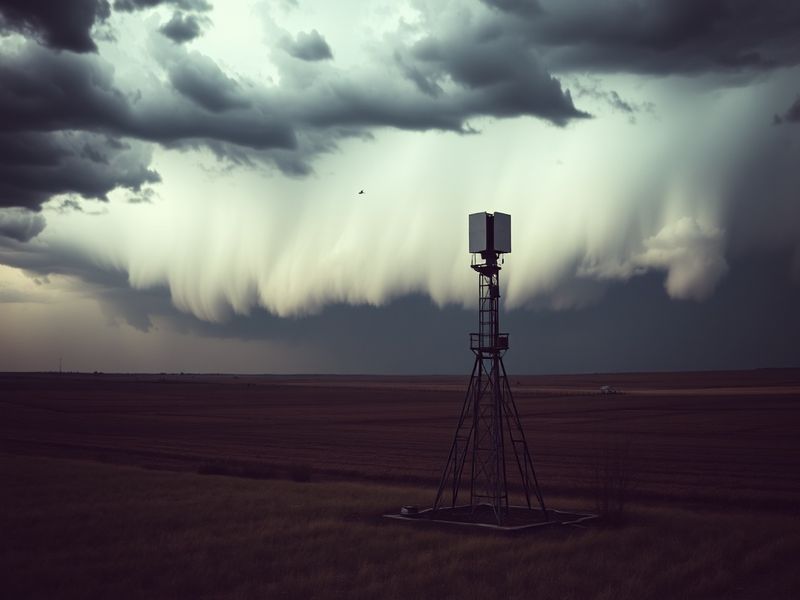
The Science Behind Tornado Radar Systems
At the heart of tornado detection is Doppler radar, which measures the speed and direction of precipitation particles within a storm. By analyzing shifts in frequency—known as the Doppler effect—meteorologists can identify rotation within a thunderstorm, a key indicator of potential tornado formation.
Modern systems, like the Next-Generation Radar (NEXRAD) network operated by the National Weather Service, use a network of 160 high-resolution S-band radars across the U.S. These radars scan the atmosphere at multiple elevation angles, creating a three-dimensional view of storm structures. When rotation is detected at lower levels, it often signals the formation of a funnel cloud or tornado.
Beyond traditional radar, dual-polarization technology has enhanced detection capabilities. Unlike conventional radar, which only measures horizontal reflectivity, dual-polarization radar also examines vertical reflectivity. This provides clearer data on precipitation types—such as distinguishing between rain, hail, and debris lofted by a tornado—which improves warning accuracy.
How Radar Data Translates Into Life-Saving Warnings
The process from data collection to public alert involves several critical steps. First, radar systems detect unusual wind patterns, such as a mesocyclone—a rotating updraft within a supercell thunderstorm. If this rotation tightens and descends toward the ground, meteorologists issue a tornado warning.
Local National Weather Service offices then relay these warnings through multiple channels: emergency alert systems, weather apps, sirens, and media broadcasts. The goal is to provide at least 10-15 minutes of lead time for residents to seek shelter. However, the effectiveness of these warnings depends on how well communities understand and respond to them.
Recent improvements in radar resolution and processing speed have reduced false alarms, which historically undermined public trust. For example, the introduction of the Multi-Radar Multi-Sensor (MRMS) system integrates data from multiple radar sources to create a more precise and real-time picture of storm behavior.
Key Advancements in Tornado Radar Technology
- Phased Array Radar: Unlike traditional radar, which mechanically rotates to scan the sky, phased array radar uses electronic beam steering. This allows for faster updates—up to 30 times per minute—providing near-instantaneous data on storm development.
- Machine Learning Algorithms: AI models trained on historical storm data can now predict tornado likelihood with greater precision. These systems analyze radar signatures, atmospheric conditions, and storm motion to highlight areas at highest risk.
- Mobile Radar Units: Doppler-on-Wheels (DOW) vehicles equipped with mobile radar units deploy directly into storm paths. These units have captured unprecedented data on tornado structure, including wind speeds exceeding 300 mph.
- Dual-Polarization Upgrades: Over 90% of NEXRAD radars now use dual-polarization, improving detection of debris and hail, which are often precursors to tornado damage.
The Human Factor: From Data to Action
Even with cutting-edge radar technology, human expertise remains vital. Meteorologists interpret radar signatures, compare them with satellite and surface observations, and make judgment calls on when to issue warnings. The Storm Prediction Center in Norman, Oklahoma, serves as a hub for this coordination, synthesizing data from across the country to identify severe weather risks days in advance.
Community preparedness plays an equally crucial role. Public education campaigns, such as the National Weather Service’s “Know Your Risk” initiative, teach residents to recognize warning signs and respond quickly. Schools, hospitals, and businesses conduct regular tornado drills, ensuring that when a warning is issued, people know exactly where to go.
Yet challenges persist. Rural areas with sparse radar coverage, such as parts of the Great Plains, still face gaps in detection. Additionally, the increasing frequency of nighttime tornadoes—often more deadly due to lower visibility—has prompted calls for improved night-vision radar and better public alert systems for sleeping populations.
Broader Implications: Climate Change and Future Directions
As climate change intensifies, scientists are observing shifts in tornado behavior. While the total number of tornadoes per year has not increased significantly, research suggests that outbreaks—clusters of tornadoes occurring in rapid succession—are becoming more common. This trend may be linked to rising sea surface temperatures, which provide more energy for severe thunderstorms.
Looking ahead, the integration of radar data with other technologies could further improve forecasting. For instance, combining radar with lightning detection networks allows meteorologists to track storm intensity in real time. Similarly, advances in computational power are enabling higher-resolution simulations, helping researchers model how tornadoes form and evolve under different climate scenarios.
Another promising area is the use of unmanned aerial vehicles (UAVs) to gather data from within storms. Projects like TORUS (Targeted Observation by Radars and UAS of Supercells) deploy drones to collect measurements at multiple altitudes, filling gaps left by ground-based radar.
The Role of Amateur Storm Chasers
While professional meteorologists rely on radar, a network of trained storm spotters—including trained volunteers and amateur meteorologists—provides ground-truth observations. Organizations like the National Weather Service’s Skywarn program train individuals to recognize tornado precursors, such as wall clouds and funnel formations, and report them in real time.
This grassroots effort complements radar technology, offering a human perspective that machines cannot replicate. Social media has amplified this collaboration, with storm chasers sharing live updates and photos that help confirm radar-based warnings.
Conclusion: A Safer Future Through Innovation
Tornado radar technology has evolved from simple reflectivity maps to sophisticated systems capable of predicting storms with remarkable accuracy. Yet, the ultimate goal is not just better data, but better outcomes. Each advance—from phased array radar to AI-driven forecasting—brings us one step closer to reducing tornado-related fatalities.
The future of tornado detection will likely be shaped by collaboration between government agencies, private companies, and citizen scientists. As climate patterns shift and severe weather becomes more unpredictable, the need for innovation has never been greater. Through continued investment in technology and education, communities can become more resilient in the face of nature’s most violent storms.
For now, the next time a tornado watch is issued, know this: the radar is watching too. And with every technological leap, it’s watching more closely than ever before.