Weather Radar Explained: How It Works and Why It Matters
Every year, severe weather causes billions of dollars in damage worldwide. From monsoons in South Asia to hurricanes in the Caribbean, communities rely on advanced tools to forecast these events and protect lives. At the heart of modern meteorology is weather radar—a technology that has evolved from military innovation to a global lifeline.
Unlike static weather stations that measure conditions at a single point, radar systems actively scan the atmosphere, painting a real-time picture of what’s happening miles above the ground. This capability has transformed how societies prepare for disasters, how airlines plan flights, and even how farmers manage crops. The story of weather radar is not just one of scientific progress; it’s a narrative of global cooperation, cultural adaptation, and the growing intersection of nature and technology.
The Science Behind the Scan: How Weather Radar Reads the Sky
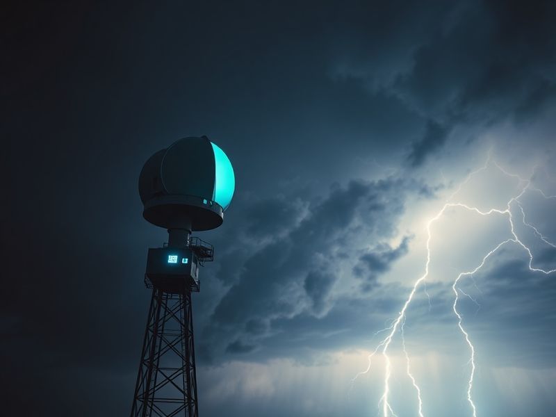
At its core, weather radar operates on a principle as elegant as it is powerful: sending out pulses of microwave energy and listening for their echoes. When these pulses encounter precipitation—rain, snow, or hail—they bounce back to the radar dish, revealing not only the location of the storm but its intensity and movement.
Modern radar systems typically use Doppler radar, which can detect the speed of moving particles in the atmosphere. This is crucial for identifying rotation in thunderstorms, a telltale sign of tornado formation. In some regions, dual-polarization radar adds another layer of precision by distinguishing between rain, sleet, and even debris lofted by tornadoes.
Around the world, different climates demand different radar strategies. In Japan, where typhoons are a seasonal threat, the Japan Meteorological Agency operates a dense network of radars to track storms approaching from the Pacific. Meanwhile, in the United States, the National Weather Service relies on a combination of government-owned and privately operated radar systems to cover vast plains and coastal regions alike.
The Global Network: From Local Outposts to Satellite Eyes
Weather radar is not a luxury—it’s a global infrastructure. Many countries operate their own radar networks, but international collaboration enhances their effectiveness. For example, the European Severe Storms Laboratory aggregates data from over 30 countries to provide cross-border warnings for severe convective storms.
Satellites complement ground-based radar by offering a view of weather systems across oceans and remote regions. While satellites can’t match radar’s resolution, they provide essential context for large-scale systems like hurricanes and monsoons. The World Meteorological Organization coordinates this global observation system, ensuring that even developing nations receive critical weather data.
In some areas, radar coverage remains sparse. Remote regions of Africa and South America rely heavily on satellite estimates, while mountainous areas like the Andes or the Himalayas can create radar “shadows” where storms go undetected. Advances in phased-array radar and mobile radar units are slowly closing these gaps, offering hope for more inclusive forecasting.
From Forecasting to Folklore: How Cultures Interpret the Weather
Long before radar, humans relied on observation and tradition to predict the weather. Many cultures developed sophisticated systems based on cloud patterns, animal behavior, or celestial events. The Māori of New Zealand, for instance, used the appearance of the star Matariki (Pleiades) to forecast seasonal changes. In India, farmers traditionally monitored the direction of monsoon winds and the behavior of ants to anticipate rainfall.
Today, these cultural practices coexist with cutting-edge technology. In parts of rural India, farmers use smartphone apps that integrate radar data with traditional knowledge, helping them decide when to plant or harvest. Similarly, in the Pacific Islands, community leaders combine radar alerts with indigenous knowledge of tidal patterns to prepare for cyclones.
Yet, the introduction of radar hasn’t always been seamless. In some communities, skepticism persists. Elders may distrust modern forecasts, preferring to rely on ancestral methods. This tension highlights the importance of bridging science and tradition—ensuring that new tools complement, rather than replace, cultural wisdom.
Everyday Heroes: The People Who Turn Data into Action
Behind every radar blip and weather alert is a team of meteorologists, emergency responders, and volunteers working to translate data into real-world decisions. In the Philippines, a country frequently battered by typhoons, the state weather bureau uses radar data to issue warnings that reach remote fishing villages via radio and text message.
In Europe, meteorologists at regional forecasting centers coordinate with local authorities to activate sirens, open shelters, and deploy rescue teams. During the devastating floods in Germany in 2021, radar data enabled authorities to issue timely evacuations, saving thousands of lives.
Private sector involvement also plays a role. Companies like Weather Company (owned by IBM) and AccuWeather sell radar-based services to businesses, helping energy providers prepare for storms, airlines reroute flights, and event planners move concerts indoors. In agriculture, companies offer subscription-based radar tools that help farmers time irrigation and protect crops from frost.
The Future of Weather Radar: Smarter, Faster, More Accessible
The next frontier in weather radar is already unfolding. Artificial intelligence is being integrated into radar systems to improve storm prediction and reduce false alarms. Machine learning models can analyze decades of radar data to identify patterns that human forecasters might miss.
Another innovation is dual-frequency radar, which uses two radar bands (such as S-band and X-band) to provide higher resolution and better detection of small particles like drizzle or volcanic ash. This technology is particularly valuable for aviation safety, as it can alert pilots to ash clouds that could damage engines.
Accessibility is also improving. Low-cost radar kits and open-source software are enabling hobbyists and small communities to build their own weather networks. In Kenya, a project called “AfriWeather” is training local technicians to maintain radar systems, empowering rural areas to take ownership of their weather data.
Looking ahead, the integration of radar with other technologies—drones, IoT sensors, and satellite constellations—could create a seamless, global weather monitoring system. Such a system would not only improve forecasts but also help scientists study climate change impacts in real time.
A Call to Look Up
Weather radar is more than a technological marvel; it’s a testament to human ingenuity and our enduring quest to understand the skies. From ancient stargazers to today’s AI-driven models, the tools have changed, but the goal remains the same: to see the invisible, predict the unpredictable, and protect what matters most.
As climate change intensifies storms and disrupts weather patterns, the role of radar will only grow more critical. It’s a reminder that in a world of uncertainty, reliable information is power—and radar gives us that power in real time.
Next time you check the weather app and see a swirling radar image, take a moment to appreciate the invisible pulse of energy scanning the sky above you. It’s not just data. It’s a lifeline.