Lightning Maps: How Real-Time Tracking Keeps You Safe
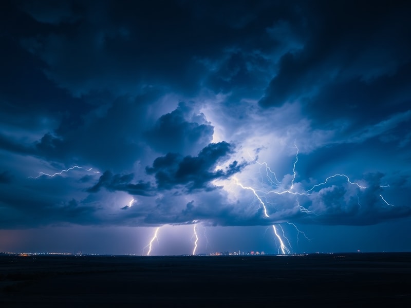
Lightning maps have transformed how we track and understand one of nature’s most powerful forces. These digital tools provide real-time data on lightning strikes, helping meteorologists, emergency responders, and outdoor enthusiasts stay informed and safe. Unlike traditional weather reports that focus on forecasts, lightning maps offer precise, location-based information that can be critical during severe storms.
At their core, lightning maps aggregate data from a network of sensors that detect the electromagnetic pulses produced by lightning strikes. These sensors, often spaced hundreds of miles apart, triangulate the exact location of each strike by measuring the time difference between the signal’s arrival at multiple points. The result is a dynamic visualization that updates within seconds, showing the intensity, frequency, and movement of storms across a region.
The technology behind these maps has evolved significantly over the past decade. Early versions relied on ground-based systems with limited coverage, but today’s networks incorporate satellite data and advanced algorithms to improve accuracy. For example, the U.S. National Lightning Detection Network (NLDN) detects over 20 million cloud-to-ground strikes annually, while the European Cooperation for Lightning Detection (EUCLID) covers much of the continent with similar precision. These systems can pinpoint a strike within a few hundred meters, making them invaluable for both research and public safety.
How Lightning Maps Work: The Science Behind the Data
Lightning maps depend on a combination of hardware and software to function. The hardware includes sensors that detect the radio waves emitted by lightning, often referred to as sferics. These sensors are strategically placed across large areas to ensure comprehensive coverage. When a strike occurs, the sensors pick up the signal and send the data to a central processing hub, where algorithms calculate the strike’s location.
The software then converts this raw data into a user-friendly map, often color-coded to indicate the intensity of each strike. For instance, darker colors might represent stronger or more frequent strikes, while lighter colors indicate weaker activity. Some platforms also overlay this data with other weather information, such as radar or satellite imagery, to provide a more complete picture of storm systems.
One of the most advanced systems is the Global Lightning Network (GLN), which combines data from over 500 sensors worldwide. This network not only tracks cloud-to-ground strikes but also monitors intra-cloud and cloud-to-cloud activity, which can precede severe weather events. Researchers use this data to study storm formation, while emergency services rely on it to issue timely warnings. The GLN’s global reach ensures that even remote areas are covered, reducing gaps in detection that could otherwise leave populations vulnerable.
Why Lightning Maps Matter: Safety and Beyond
For outdoor enthusiasts, lightning maps are an essential tool for avoiding dangerous situations. Hikers, campers, and golfers often find themselves in exposed areas where lightning poses a serious risk. A map that shows real-time activity can help them decide whether to seek shelter or delay their plans. For example, if a storm is moving toward a popular hiking trail, users can adjust their route or wait it out until the danger passes.
Emergency responders also benefit greatly from this technology. Firefighters, paramedics, and law enforcement agencies use lightning maps to coordinate responses during severe weather events. In wildfire-prone regions, lightning strikes are a primary cause of fires, and early detection can mean the difference between a small blaze and a full-blown disaster. The National Weather Service in the U.S. integrates lightning data into its warning systems, providing alerts to local communities when conditions become hazardous.
Beyond safety, lightning maps play a crucial role in scientific research. Climate scientists study long-term trends in lightning activity to understand how global warming might influence storm patterns. For instance, some studies suggest that warmer temperatures could lead to more frequent and intense lightning strikes, which could have implications for wildfire frequency and atmospheric chemistry. By analyzing decades of data from networks like the NLDN, researchers can identify correlations between temperature, humidity, and lightning occurrence.
Popular Lightning Map Tools and How to Use Them
Several platforms offer lightning maps, each with its own features and strengths. Here’s a breakdown of some of the most widely used tools:
- Blitzortung: A community-driven network that relies on volunteers to host sensors. It provides real-time data with a global reach and is free to use. The platform’s simplicity makes it accessible to casual users, though its accuracy may vary in areas with fewer sensors.
- LightningMaps.org: Another free service that aggregates data from multiple networks. It offers a clean, interactive interface with customizable layers, such as radar and satellite imagery. Users can also set up alerts for specific locations.
- Weather Underground’s Lightning Map: Integrated with the popular weather service, this tool provides detailed strike data alongside forecasts and radar. It’s particularly useful for those who want a one-stop solution for all their weather needs.
- NOAA’s Lightning Explorer: Developed by the National Oceanic and Atmospheric Administration, this tool focuses on the U.S. and is highly reliable for official weather tracking. It includes historical data, making it valuable for researchers and analysts.
When using these tools, it’s important to understand their limitations. For example, some maps may not update as frequently in remote areas due to fewer sensors. Additionally, the data represents only cloud-to-ground strikes, so intra-cloud activity—which can still indicate severe weather—may be underrepresented. Users should cross-reference lightning maps with other sources, such as local weather reports, to get the most accurate picture.
The Future of Lightning Tracking: AI and Beyond
The next frontier for lightning maps lies in artificial intelligence and machine learning. Researchers are exploring how AI can improve the accuracy of strike detection by analyzing patterns in vast datasets. For instance, algorithms could be trained to predict where lightning is likely to strike based on current weather conditions, such as wind speed and atmospheric instability. This could lead to more proactive warnings, giving people even more time to prepare.
Another exciting development is the integration of lightning data with other emerging technologies. Drones equipped with sensors could be deployed to areas with sparse coverage, providing real-time data from the sky. Similarly, the rise of the Internet of Things (IoT) means that smart devices in homes and vehicles could receive lightning alerts tailored to their exact location, further enhancing safety.
Climate change may also drive innovation in this field. As lightning activity is expected to increase in some regions, demand for advanced tracking tools will grow. Governments and private companies are likely to invest more in sensor networks and data analysis, ensuring that lightning maps become even more precise and reliable in the years to come.
For now, lightning maps remain one of the most effective ways to monitor and respond to severe weather. Whether you’re a scientist, a first responder, or simply someone who enjoys the outdoors, these tools offer a vital lifeline in an unpredictable world. By staying informed and using the right resources, we can all reduce the risks posed by one of nature’s most spectacular—and dangerous—phenomena.